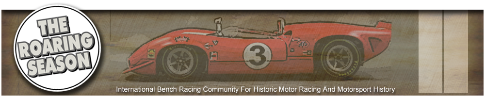
Laguna Seca, 1968. Note the stricken Chaparral in the background.


Laguna Seca, 1968. Note the stricken Chaparral in the background.
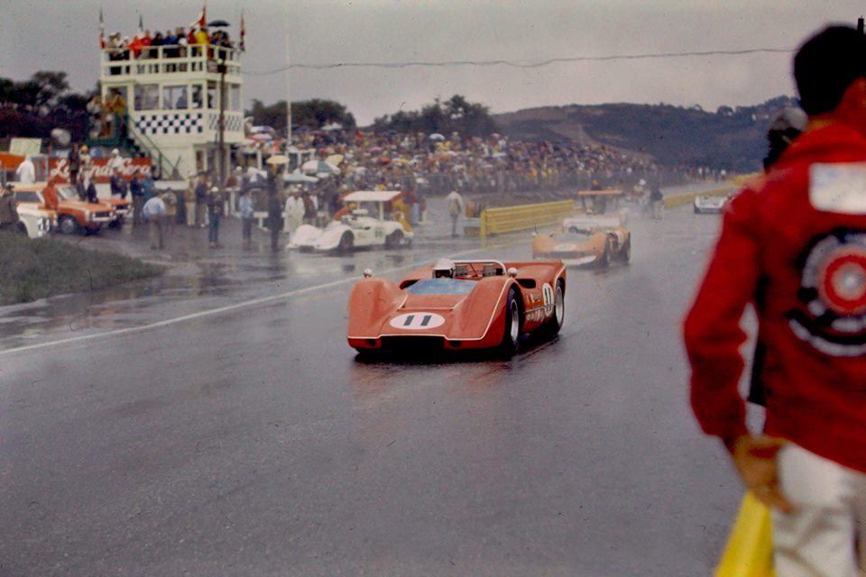
Bruce McLaren's 1968 M8A.
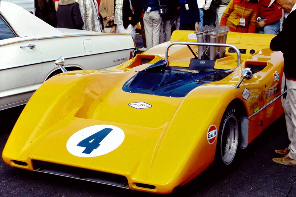
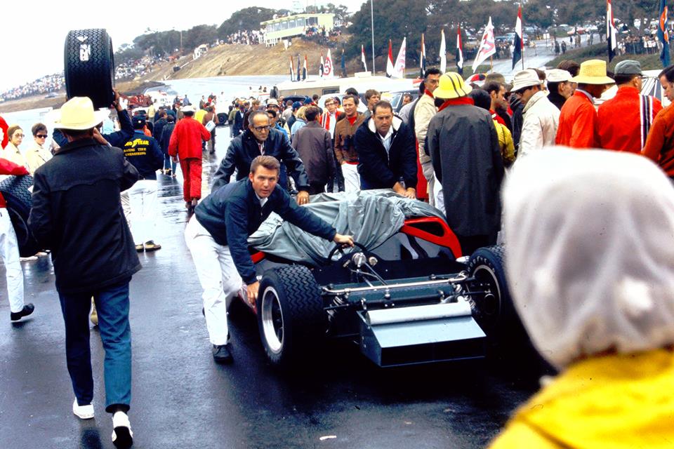
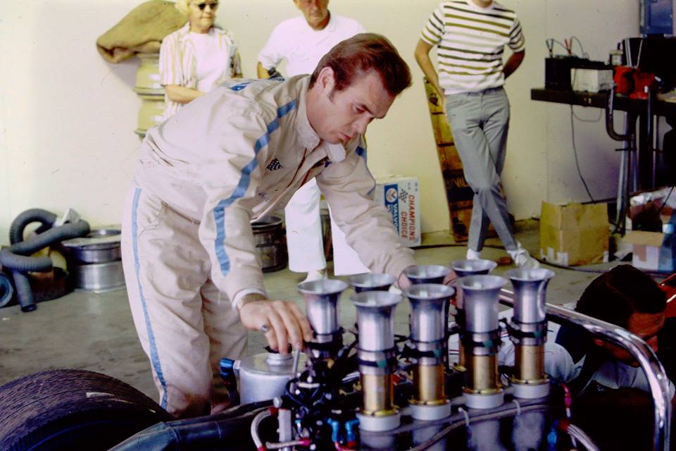
Dan Gurney looks on as his crew prep his Lola T70.
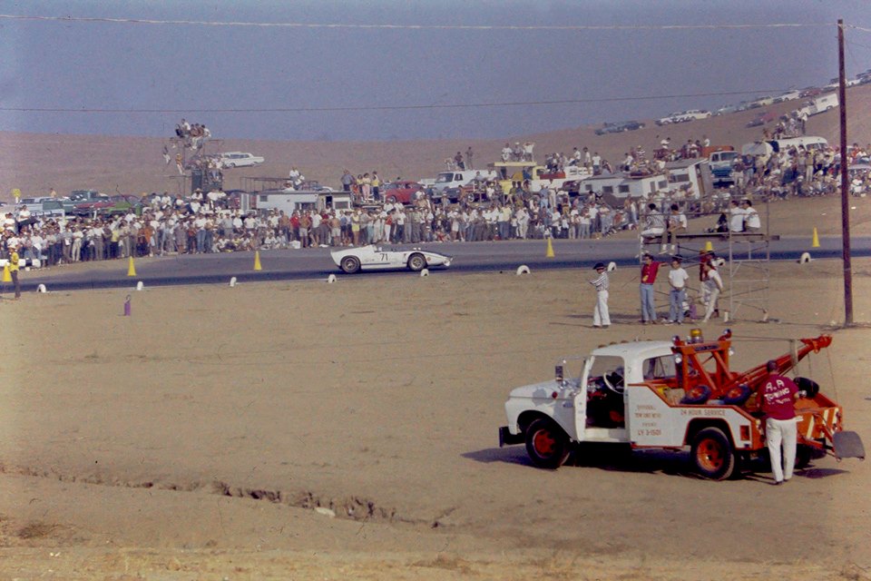
Riverside. The big Ford rumbles past. Love the tow truck.
Steve,
That is a unique shot of Turn 8 at Riverside before the cars went on to the long Back Straight.
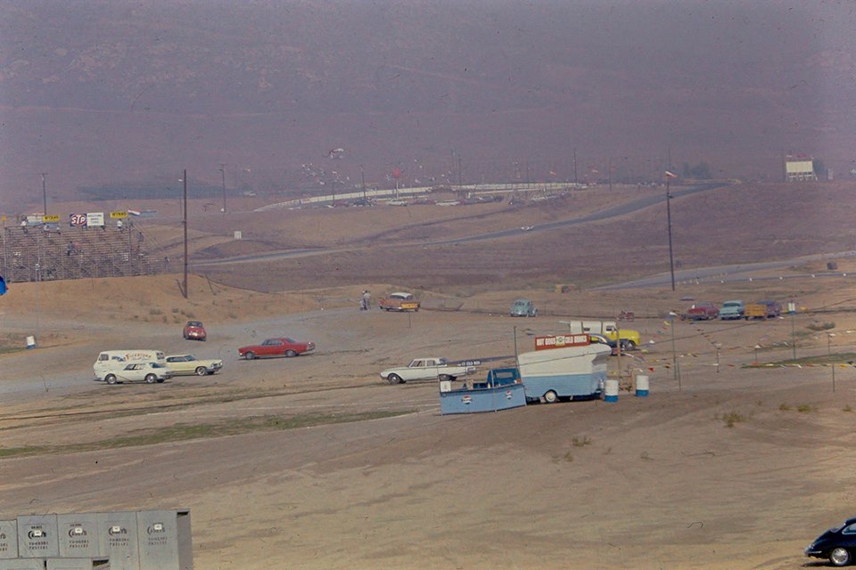
This is how that area looks today.
(Note that the air is cleaner, compared to that shot of Dan Gurney by the Lola T70 where you can just see across to other side of the track! )
(Ken H)
Last edited by khyndart in CA; 04-18-2018 at 08:15 PM.
Wow, great comparison Ken! Thank you. So interesting to see what becomes of these old tracks. I understand that Riverside became quite tired and run down by the 1980s, but it would have been nice if it had survived and been revived. As a race track it had such a nice layout and flow.
The smog you mentioned is well captured in this photo.
This 1967 Can-Am feature captures some of the best parts of the Riverside course:
Laguna Seca 1968 Can-Am.
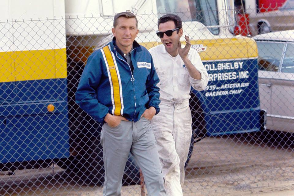
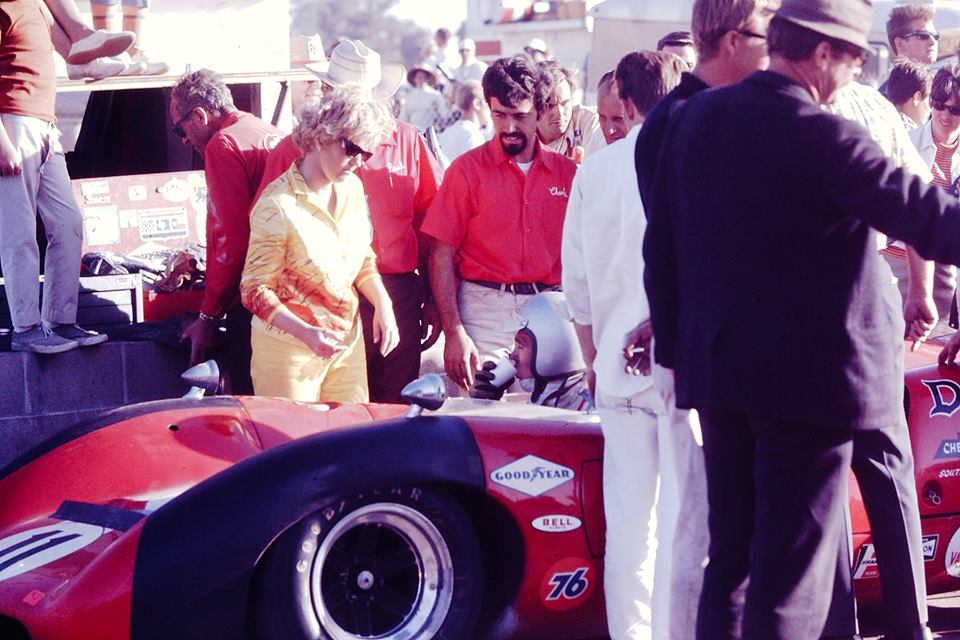
Denny Hulme visits Lothar Motschenbacher's pit garage. I'm pretty sure thats Carroll Smith in the middle.
OK I just found out thats Hershey Entin in the centre. I assume a relation of Jerry Entin.Originally Posted by Steve Holmes

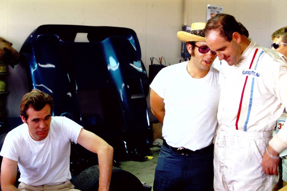
Dick Guldstrand at left. Brilliant GM engineer and also a very successful driver. He passed away just a couple of years ago at age 87.
This is Bob Bondurant's modified Lola T70. Bondurant was a very successful racer, and drove for Shelby for a few years. But he is perhaps best known for the racing school he established to teach people how to drive a race car. This was the first such school of its type, and came about after Bondurant served as a technical consultant on the movie Grand Prix, where he taught James Garner how to drive. He established Bob Bondurant School Of High Performance Driving in 1968. The idea came to him while recuperating from a nasty shunt in 1967.
Ray.....see old map below......"NEW EXIT" is the tee junction at the top of the current entry road just after the toll booths.
That intersection is center left in the picture......the current camp ground is under the trees left of that again.
Photo taken from the access road after the turn 4 bridge (not there at the time of course).
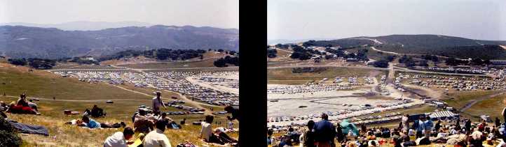
BTW.....pic3 is a continuation to the left of pic2 .......those 2 pictures are the "Laguna Seca" (Spanish for Dry Lake)
Scrutineering and paddock parking/pit allocation is done on that dry lake bed to this day.
Jim Grant
Thanks for the explanation, I've done up a bit of a composite...
There's a gap in the middle and heights and maybe focal length and location of the camera are different, but it gives the idea.
Interesting.. Moffat was friends with Sam Posey. They shared a Sebring victory together.
This is Lothar with his McLaren M6A when he upgraded to big block Chevy power.
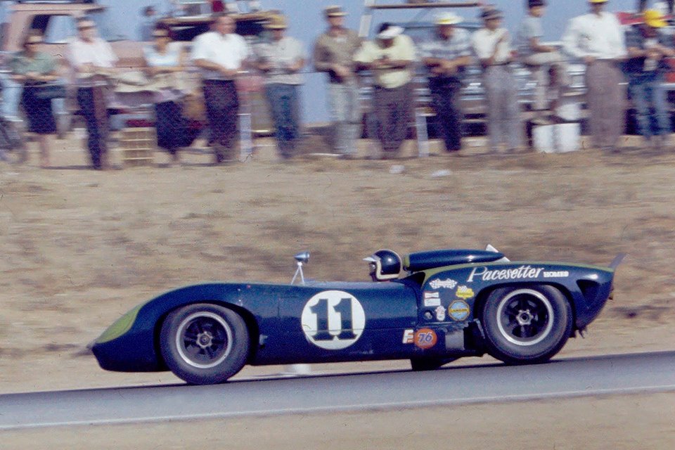
Lothar's Lola T70.
 Posting Permissions

 Reply With Quote